Text taken from: Silk Road Cities. Documented through photographs, prints and postcards.
The city of Marv
Marv is an ancient city along the Silk Roads situated in the delta of the Murgab river, which flows northwards from Afghanistan and forms an oasis at the southern edge of the Karakum Desert. Archaeologists have found remains of settlements that date back to the 3rd millennium BC. In the 4th century BC the eastern territories ruled by Alexander the Great became part of the Seleucid Empire (312-63 BC). In the 3rd century BC Antiochus I (281-261 BC) began a massive expansion of the city. The earliest settlement of Erk Kala was converted into a citadel and a new walled city Antiochia Margiana was laid out. This Hellenistic city, called today Gyaur Kala, had two orthogonal axes oriented along the cardinal points; there were four main roads dividing it into four quadrants. The citadel Erk Kala was situated at the northern edge within the city wall, which was 10 m wide and had 100 bastions. In the southwestern comer, the Razik canal flowed through a vaulted tunnel.
The Parthians (247 BC-224 AD) and then the Sasanians (224-651) developed Marv as a major administrative, military and trading hub. After the 7th century Marv became the centre for the Arab expansion to the east. During the late 7th century the first mosque, the Banu Makhan, was built exactly in the centre of the Gyaur Kala, at the intersecting points of the two orthogonal roads. In the 740s Abu Muslim took control of Marv to proclaim the start of the ‘Abbasid expansion. Baghdad was soon established as the capital of the new empire, but Marv’s status as the capital of Khorasan had grown and now the eastern ‘Abbasid Caliphate was administered from here. Abu Muslim (718-755) commissioned a new mosque to be built alongside the Majan canal, about 1 km to the west of the Gyaur Kala city wall; the old Banu Makhan Mosque had become too small for the increasing number of Muslim worshippers. Between 813-818 Marv became Caliph al-Maʾmun’s (786-833) residence and thus the second capital of the ‘Abbasid Caliphate (750-1258). Although there are no remaining architectural monuments from that time, we know that the Banu Makhan Mosque was restored. The departure of Caliph al-Maʾmun to Baghdad led to the gradual decay of the Gyaur Kala. However, Marv grew to the west.
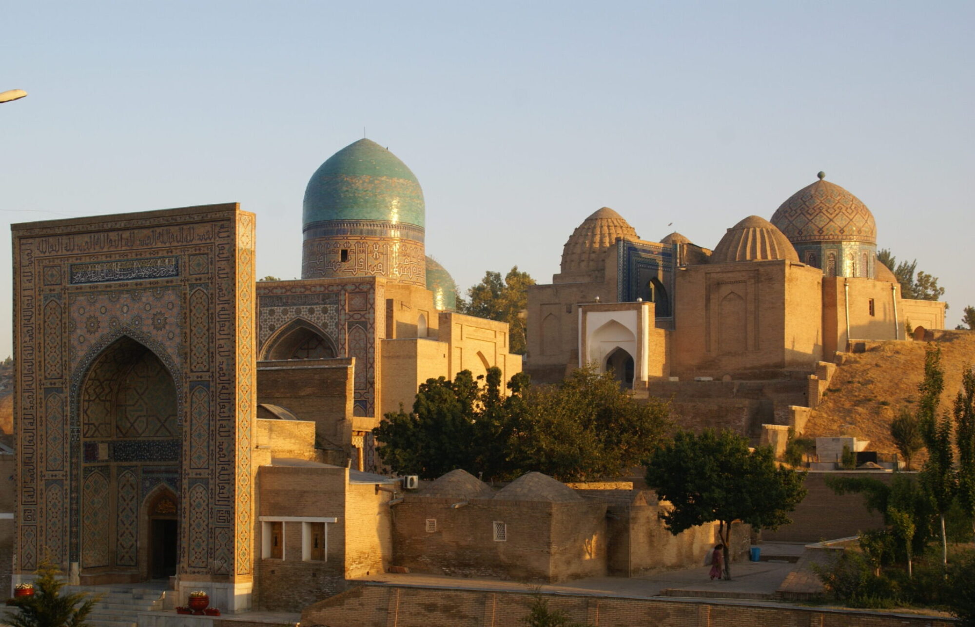
By the 11th century Abu Muslim’s mosque was at the heart of the new city of Marv the Great, known today as Sultan Kala. Sultan Kala continued to expand and develop under the Saljuqs (1038-1194) in the northern and southern directions along the Majan canal. During the reign of Sultan Malik Shah (1055-1092), the central square part of the Sultan Kala was built and the city was surrounded by a new wall with 200 semi-circular towers. In that period, life also continued in the old shahristan (the Gyaur Kala). Marv became the imperial capital of Sultan Sanjar (r. 1118-1157) and the largest town in Central Asia with an area of 1,800 hectares and a population of 150,000 people. Under Sultan Sanjar, a new citadel was erected in the northeastern corner of the Sultan Kala for the administrative and military needs of the new ruler.
In 1221 Marv was fully destroyed by the Mongols. 200 years after the Mongol invasion Marv was restored by Timur’s son Shahrukh (1377–1447), who issued orders to rebuild the city in 1418. Due to water shortage, the new town was moved 2 km to the south of the Sultan Kala. The remains of Timurid Marv are known as ‘Abdallah Kala.
Sources for Marv
Archnet: Mausoleum of Sultan Sanjar
Oriental Architecture: Mausoleum of Sultan Sanjar